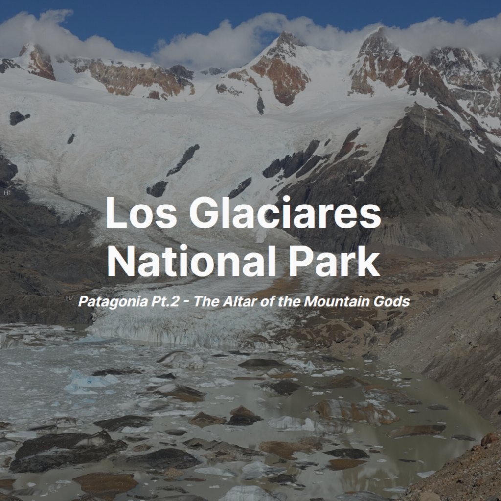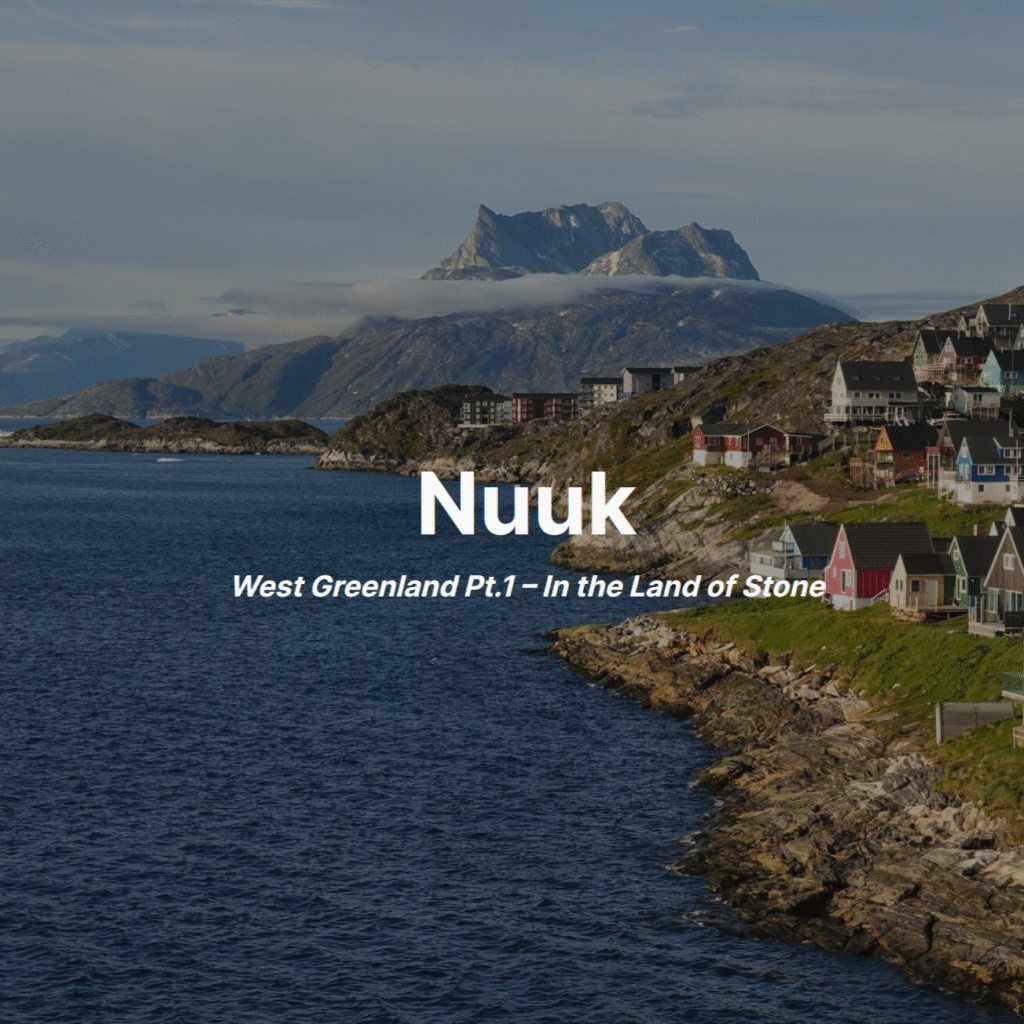
Nuuk
West Greenland Pt.1 – Land of Stone
Introduction
18 July 2025 – 2 August 2025
Part 1 of the Greenland 2025 trip.
Back in 2020, I had an exciting trip to Greenland booked with my mum. Unfortunately, everyone got a little authoritarian that year and the trip had to be canceled. Five years later, it was finally time to revisit the destination!
Greenland has a lot to offer, with three self-contained regions: West, South, and East. West Greenland is the most accessible and contains the capital Nuuk, the Arctic Circle Trail, and Disko Bay. South Greenland has the magnificent Tasermuit Fjord and historic Viking settlements. East Greenland is almost uninhabited, with really only one small settlement but holds incredible mountaineering options. Each region is fully deserving of attention, but with poor transit connections between regions, it is really only possible to do one in a single trip. With the culture of Nuuk and Ilulissat’s icebergs, West Greenland was the obvious starting point.
Because we already had a fully formed plan from the 2020 trip, a lot of the legwork had already been done. But a new year meant a fresh chance to revisit things. The basics remained the same, but some time and transit calculations needed to be reassessed.
As the capital, and by far the largest settlement, Nuuk was an obvious choice for a base in West Greenland. Nuup Kangerlua, the fjord complex that surrounds Nuuk would offer both good hiking options and completely different geography to Disko Bay. My primary goal was to explore the mountain ridge immediately east of town, with the capital’s museums filling any bad weather days. I was very tempted by a rough trek from Kapisillit, a tiny settlement at the top of the fjord and accessible by fastboat ‘ferry’, back to Nuuk. I couldn’t justify the time investment, particularly given the unknown, but difficult, terrain conditions and high probability of prolonged periods of poor weather. It is possible to shorten the trek but that requires booking a very expensive water taxi.
Arrival
Friday, 18 July
Back in 2020, Greenland had only one runway capable of handling Air Greenland’s single A330 (that A330 has since been replaced with an A330NEO). As a result, almost all arrivals were made through the old US airbase in Kangerlussuaq. A new runway and terminal were opened in Nuuk this winter, so we were able to skip a stop on the big flights. A very welcome change, both for us and for Greenland’s connectivity, though I am concerned about the inevitable consequences – the world really doesn’t need another Iceland.
The trip got off to a dreadful start. Before even leaving for the airport I received a text stating that there were technical difficulties with the aircraft and we would be delayed by an hour. We had over three hours in Keflavik, so that wasn’t too worrying. Arriving at the gate, I saw an archaic narrowbody 757 instead of the (equally archaic) widebody 767 I was expecting to see. The aircraft change meant a change in seating configuration and non-trivial capacity reduction. Schiphol’s computers decided that they weren’t going to cooperate and the cabin crew had to manually reassign roughly half the passengerlist. This was not helped by the fact that many boarded passengers hadn’t waited for ‘boarding complete’ to be announced before deciding to move seats. The next flight to Nuuk wasn’t until Monday night, and by the time we were airborne the odds were not looking good. Fortunately, Iceland decided to honour Schengen (a rarity in 2025) and we were able to make the onward flight in relative comfort.
The descent into Nuuk was spectacular with moody wisps of dark cloud swirling around the rugged peaks and sheer drops of the islands north of town. It was exactly the visuals one conjures when thinking of the Greenlandic fjords.
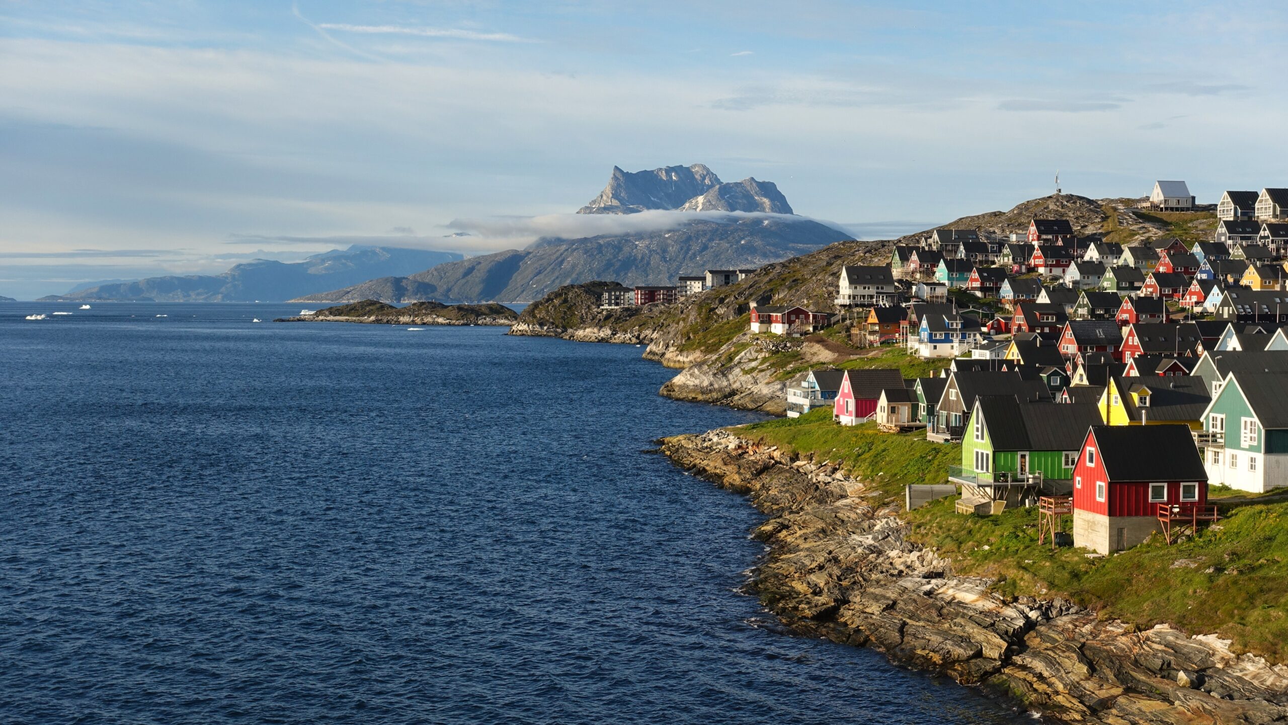
After a very uninspired food haul, I got out for a quick walk around town. My target was to take the boardwalk along the coast to a particularly nice view of Sermitsiak, the island summit that towers over Nuuk, with colourful houses in the foreground. I understand the historic connotations of red and white paint in the Nordics, but it is nice that Greenlanders have learned that other colours exist too – tradition is great, but so is having a lime green house.
Myggedalen: Mosquito Valley – a very fitting name


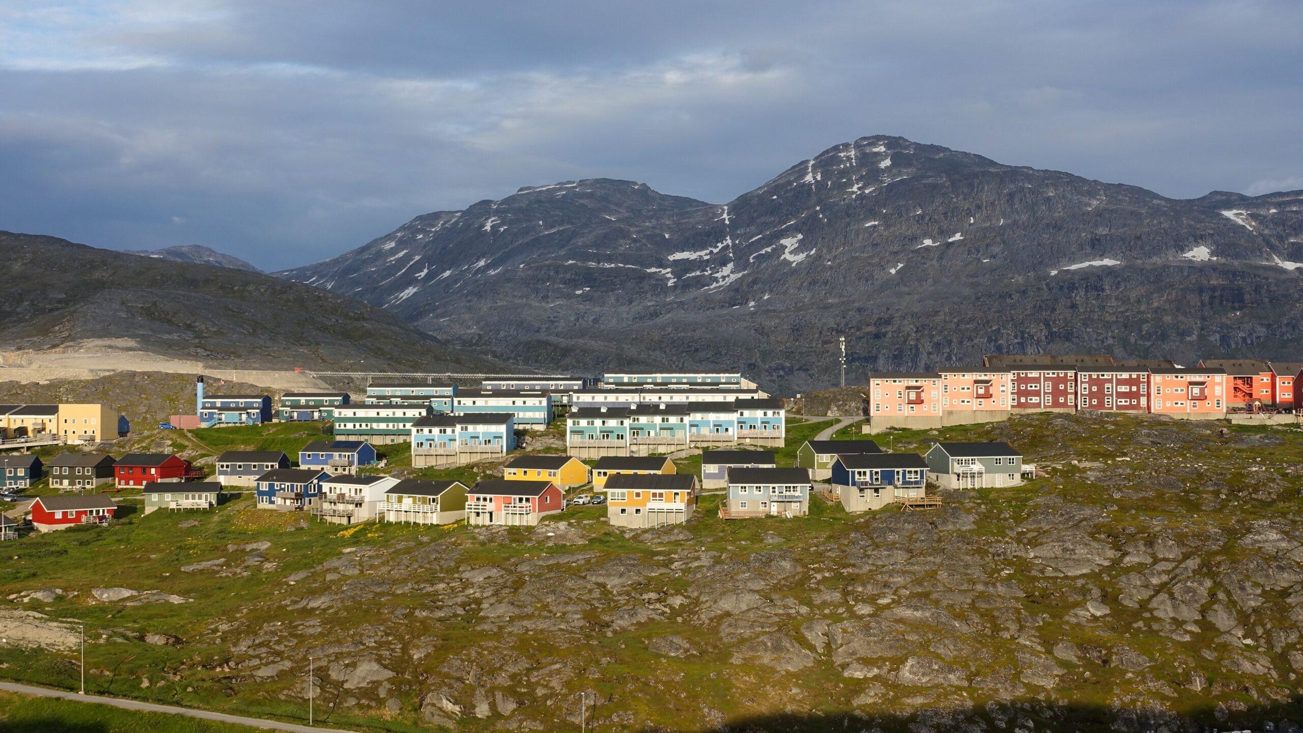
Old Nuuk (along with a healthy dose of new-builds)
It would have been interesting to see Kangerlussuaq. It is distinctly different to the other parts of Greenland, being quite dry, nearly arid. The settlement was founded in 1941 by the US Army Airforce, with the rather original name Bluie West-8 (later Sondrestrom AFB), as a shuttle point on the way to Europe. When US occupation ended in 1992, it was renamed. Because the settlement exists solely due to the airbase/airport, it will almost certainly die off with Greenland’s infrastructure boom. A stop didn’t make sense in 2020 though, and it certainly didn’t in 2025.
Ukkusissat
Saturday, 19 July
My hiking goal for the day was to get out to Ukkusissat, Nuuk’s local peak, whilst getting the general lay of the land. There is very little information regarding Greenlandic hiking circulating on the internet so I did not have a good idea of what to expect. A big part of the day was going to just be calibrating and reconnaissance, but of course I hoped for more.
Nuuk is not a big place, but reaching the start of hikes would take some time. I could begin my hike on either shore of Nuuk’s peninsula, with both requiring a lengthy walk-in on road. I arbitrarily decided to start with the north. The early stages of the walk were both pleasant and interesting. About halfway it became a bit of a bleak slog as I rounded the massive wall of rock debris used to to flatten the ground for the airport (the original runway construction). Eventually I made it off the road. My paper map seemed to be a bit dated though. Instead of starting my hike from ‘historic Greenlandic peat houses’, I arrived at Greenland’s brand new prison on a road that my map thought was a trail. A beautiful complex – I wonder if they are accepting bookings? World class views of Sermitsiak, hiking on your doorstep, and considerably more luxury than my Dutch hovel.
I started on a lowland horseshoe track around the back of Quassussuaq that led to Qinngorput, a neighbourhood (satellite town?) on Nuuk’s southern coast. I had the vague idea that I would ascend an unnamed top next to Ukkusissat before traversing over and descending the normal Ukkusissat route. With the mosquito swarms particularly intense, I missed where I should have started my ascent. I did see a likely route but pausing, or even slowing, to properly read the map or scout the slope was not really an appealing option… Yes, the mosquitos were that bad. Part of the reason I was going this direction is I knew that there should be an obvious route if I missed, or didn’t like, the ‘recommended route’ I intended to use.
Even the standard route was a nice ascent, with basic scrambling not dissimilar to Glencoe’s Curved Ridge. There were some lengthy snowfields lingering on the upper slopes. They could have been avoided, but it was much faster and infinitely more fun to cruise right up them. More a job for trekking poles – I have long thought them a bit of a niche usecase so have not yet acquired a set. The gully axe I had on me was definitely not the tool for the job, but it is what I brought [to Greenland]. I should probably just buy some poles…
The Greenlandic fjords really are quite something. Definitely more dramatic than their Norwegian cousins. The elevations are roughly the same, but the scale just seems grander and the drops more pronounced. It was disappointingly hazy though. And the best views, looking up Nuup Kangerlua, had particularly poor visibility.


Nuuk from Ukkusissat
Not the best start to the trip. But overall, another good reminder of why I like to have warm-up day to familiarze with the area… I needed to calibrate time to trailhead, actual terrain, temperature, sun positioning, and there are always complete unknowns.
Bad Weather Day
Sunday, 20 July
Sunday’s forecast was never looking promising. It was therefore the obvious choice for a cultural day visiting the National Museum. It was a decent museum but often very heavy handed with the colonialism message, handled in a way that fell very flat in delivery. Overall, the museum was a missed opportunity, I thought. This is all too common for me. If I am interested enough to visit a museum, I probably already have a pretty good grasp of the basic information. There were some good displays and artifacts, but typically without sufficient supporting information. As an example. there was a great collection of boats and kayaks – something I enjoyed, but there was no additional information other than the region they were from. I would have been interested to hear more about the design differences between like-types or how the may have developed over time.
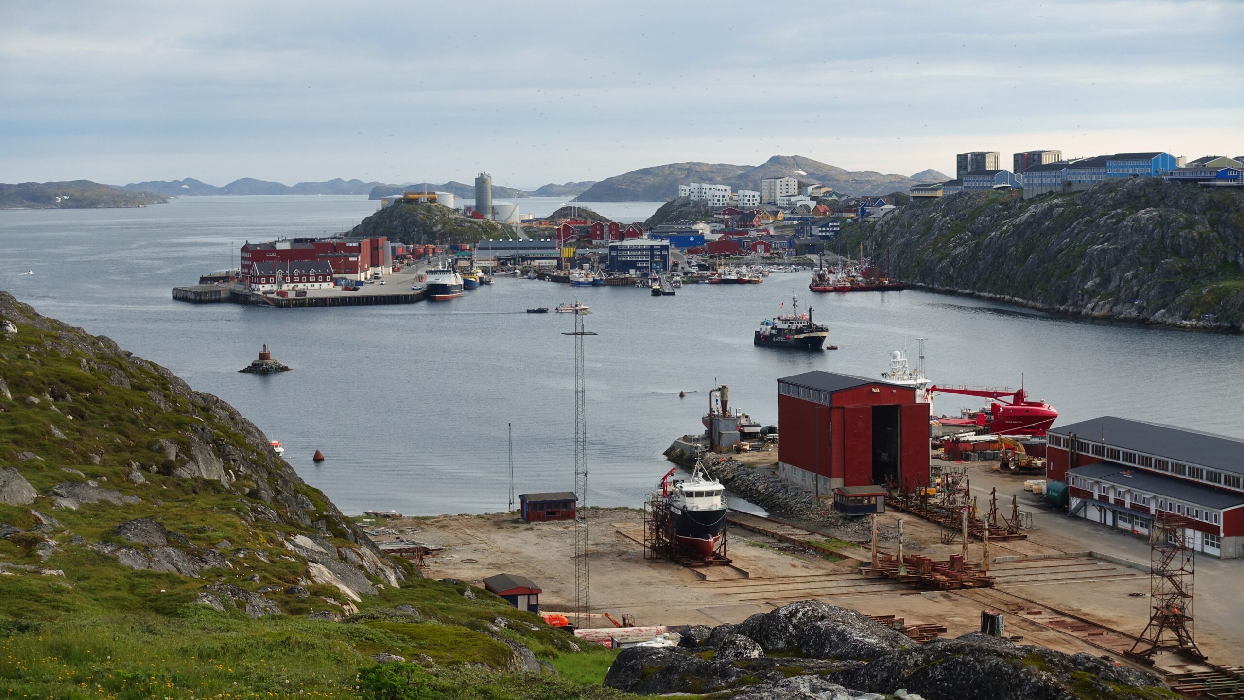
It was a very dreary morning, but by late afternoon it was dry and things were starting to clear out. By late evening, it was well worth getting out and about town for a bit of photography and urban bouldering. I actually had a lot of fun on the rocks above the harbour. Heavy fog was descending over Quassussuaq as I headed back. It was quite a cool effect, so I regretted not sticking around longer.


It actually turned out to be a pleasant evening. Until the fog rolled back up the fjord
Such days are expected when visiting these destinations and downtime was built into the scheduling. The hope is that they can be kept to a minimum.
Unnamed Top
Monday, 21 July
This time, my goal was to do the unnamed top at the centre of the mountain ridge. I had several options for how to accomplish this. At the point of departure, I had it in my head that I would ascend the top from the side of Ukkusissat and traverse toward Udsigten and Kangilequtaat. Things played out a bit differently.
I headed out across town, via Qinngorput this time and took the standard Ukkusissat track until I was roughly halfway up and reached the plateau dividing Ukkusissat from my top. Here the real fun began. I turned east and made my own path forward. Not particularly difficult, but it was quite a fun scramble with a properly wild feel!
At the top, it was decision time. Because I had ascended a top midway down a ridge, I could either double back and return to Ukkusissat, or I could continue east for Udsigten, the next top on the ridge. Ultimately I decided to return to Ukkusissat in hopes of being able to enjoy Ukkusissat’s views of Kingittorsuaq with better visibility. It would have been more fun to scramble Udsigten, but I probably made the right decision. I was glad to have gotten the view that haze had denied the previous afternoon and I would see the next evening that it probably would have turned into quite a late night if I had continued east.
On the descent I had a nice chat with a few locals. One was someone who I had contacted regarding the possibility of doing one of the island peaks of Nuup Kangerlua.

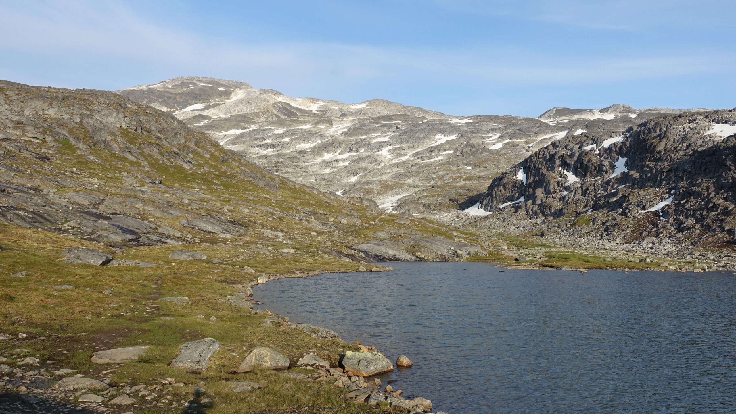
Kingittorsuaq


Much clearer views!
Another long slog back, and this time it was old news. I did get an unexpected shock passing under Runway 04’s new ILS lights though, as IcelandAir’s Max8 took off directly overhead. Not sure what CFM is doing with those engines, but seemingly nearly silent – well done.

The long walk home. A sign stating ‘Nuuk 5.5km’ is always wekcome after ‘finishing’ your hike
Kangilequtaat
Tuesday, 22 July
I still hadn’t completed the mountain ridge east of Nuuk. Kangilequtaat – the highest and furthest tops, was therefore my target. I hoped that it would provide an interesting ascent, rewarding with views of Nuup Kangerlua and Nuuk’s peninsula.
I started with the long slog back to the prison, this time taking the lower track east, which would carry on (by no means as an established track) all the way to Kapisillit. About a kilometer into my hike, I met back up with the end of the road extending from the prison and satellite dome. Nuuk is expanding so rapidly that even online maps are not keeping up…. I could have saved some time and energy, but the single-track was more pleasant than the road would have been.
Unlike the lowland track behind Quassussuaq, this one was very pleasant. There seemed to be fewer mosquitoes and the views were much nicer. Before long, I reached the lake where I was due to turn off and ascend via a climbers track. Once again, it was an excellent scramble. To my surprise, I was not alone back there as I spotted a pair on a snowfield ahead of me. They were a local couple and stopped at an obvious terminus, well short of the true summit, but with tremendous views. I had a prolonged chat before carrying on, the wife was from Qeqertarsuaq on Disko Island (confusingly, the Greenlandic name for Disko Island is also Qeqertarsuaq. Even more confusingly, many other islands in Greenland are named Qeqertarsuaq too.
The true summit was well worth the extra effort and delivered all the views that I was hoping for. I got a very clear sense of just how narrow Nuuk’s long peninsula is! And the views of 1000m vertical drops on islands in Nuup Kangerlua were impressive, particularly the largest island (one of Greenland’s very many Qeqertarsuaqs). I hung around for about an hour before turning back. I was almost tempted to try a descent of the eastern side of the top (therefore hiking ‘over’ the summit). It looked doable, but looks can be very deceiving in these situations. Given that there was no real benefit, I decided it better to just turn around.
 from Kangilequtaat")

Superb views from Kangilequtaat
It would have been amazing to hang out for the late-evening lighting. But that would have meant waiting another two hours, for 22:00. That was both too long to wait and would have gotten me home deep into the morning. I started my descent at 20:00 and was home at exactly 23:00.
Kissavianngnit Hut
Wednesday, 23 July
Having finally finished the mountain ridge of the mountains outside of town, I had just one self-supported objective left: Kissavianngnit Hut, one of the many shelters between Nuuk and Kapisillit. I had considered the option of doing an overnight hike out the peninsula, seeing how far I could get. The weather was due to change on Thursday, combine that with the mosquitoes and I wasn’t thrilled about the idea.
I slogged out to the prison one last time and carried on the same direction as I had the previous evening. But instead of turning south to ascend Kangilequtaat, I carried on east. Along the way there was Nedkørslen, a shelter with quite the view – though I had a better version of the same view the previous evening. There was a large flat area behind the shelter that would have been perfect for camping, The midnight views over Nuup Kangerlua would be amazing.
Nedkørslen (the descent) is an apt name. The shelter was immediately followed by a very steep descent into the valley below, where the mosquitoes turned out in force. From there, I had a few options, I could continue south, down the valley to Kobbefjord and eventually Kissavianngnit Hut, or I could climb the other side of the valley and head east across the centre of the peninsula. I opted to keep things simple and take the valley – I figured the views from fjord-level would be more different from the other days up high.

There was more evening photography that I wanted to do around Nuuk, so I wanted to be sure to be home in sufficient time to have a little rest and food before heading back out. I headed for a rocky area between Old Nuuk and Qernertunnguit, and it certainly delivered!


Colourful Nuuk
Rest Day
Thursday, 24 July
Going into the final day in Nuuk, the weather forecast very poor. All week it was predicted that Thursday would be a shift to cold and wet weather. Moving closer, it was predicted to be foggy all day, even when checking on Wednesday evening. I had accomplished the primary goals I had set out, and was certainly ready to be done with the 6km (each direction) commute to the hills, so I was very willing to accept a lazy rest day.
Still, there were two possible outings away from town: Qoornoq, and Sermitsiak. Qoornoq is an abandoned settlement on one of the islands north of Nuuk which has become a popular place for locals to enjoy summer. Sermitsiak is the island peak just north of town. Being an island, I couldn’t get there by myself, but a few days before departure, I had found a company that runs trips up it. Unfortunately, they only did Saturdays. I happened to run into the owner on Ukkusissat though, and he suggested that he could to Thursday if I wanted.
Given the steep pricetags attached to the two outings, I couldn’t justify the cost given the weather forecast. Both were steep enough to give me pause, even if good conditions were expected. I knew it was too late for Sermitsiak – that would have required advanced notice. As late as Wednesday morning, there was a single ticket left for a boat trip up the fjord to check out Qoornoq. Unsurprisingly, by Thursday morning, it had been snapped up.
Instead, I went to the Local Museum which covered life in Nuuk. I found this museum to be less my sort of thing than the National Museum, but also less heavy handed. There was very little text, particularly in English. What there was offered a brief, but reasonably balanced look at touchy subjects like Nuuk’s transition from Godthåb and the city’s ever growing development. Most memorable was the documentation of Blok P, large residential unit (housed 1% of the entire island). Part of the Danish Government’s post-war push to modernize Greenland, it was intended to bring modern Danish socialism and all the opportunities that entails to Greenlanders – what could possibly go wrong! Unfortunately, it just didn’t work for Greenlanders at a design level. The structure was a supersized port of what you still find dotted across NL or DE, the German word angstraum comes to mind.
I also had a quick look at Kalaaliaraq Market, a fresh food market designed for tradesmen to clean and sell their hunt/catch directly and something of a social/cultural hub. Greenlandic meat and fish of all sorts (I do mean ALL sorts) can be purchased, though hygiene standards leave something to be desired (the government is working on an improved location).
Frustrating to throw away a beautiful day, but I was mentally prepared for a weather induced rest day and had accomplished everything I had set out to accomplish.
Onward Journey
Friday, 25 July
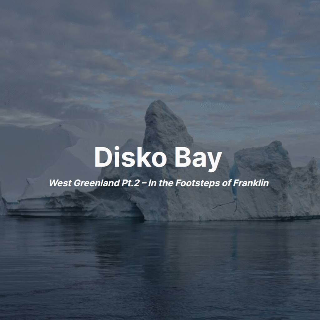
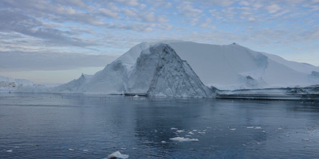
The next stop was Ilulissat to see icebergs the size of apartment blocks.
Story Continues with Pt.2
Afterwards
There were several more things I would like to have done in the area, but for varying reasons was not able to accomplish:
- Qooqqut or Kapisillit back to Nuuk multiday hike – I would love to have done the hike, but was just unable to commit to the time for Kapisillit or justify the cost of the Qooqqut boat transfer. An out and back overnight from Nuuk could have been an alternative.
- Qoornoq abandoned settlement – It would have been really interesting to see both the settlement and just have the opportunity to get deeper into the fjord. That section of Nuup Kangerlua is particularly dramatic. The pricetag was sufficiently high that I was very hesitant to book without fair weather, though I regret not just going for it.
- Sermitsiak scramble – It would have been particularly special to do one of the island tops. Being on an island, I had no way to do it self-supported and the pricetag was even higher than Qoornoq.
Perhaps the lesson here is just to commit from the planning phase. By waiting to see conditions, I left not even trying as the path of least resistance and far too easy an out. On the other hand, I was basing my decisions by aggregating as many weather forecasts as I could, and the costs involved would have really stung if conditions were poor. I had equally viable options that mitigated the risk whilst keeping options open.
I sometimes struggled with the conditions not living up to the astronomical standards of El Chalten, my most recent big trip. I knew that was never a fair comparison though. Chalten was a unicorn; day-in, day-out, I had the kind of perfect conditions that one can really only dream of. A rational assessment would indicate that conditions in Nuuk were far better than can be expected, particularly in a a region infamous for rain and/or heavy fog. The switch from morning offering perfect lighting to evening was also an adjustment. Going out in the early morning meant I could relax all afternoon, reflecting on a successful day where the evening departure meant that I was awkwardly waiting around most of the day.
I hope to return to Greenland to see the other regions. Mountaineering in remote East Greenland has particular appeal and is definitely within reach. Tasermiut Fjord in South Greenland unquestionably one of the most dramatic fjords on the planet too though. Unfortunately, the logistics behind Tasermiut, particularly solo, are exceedingly expensive.
Footnote
All photos are exclusive property and may not be copied, downloaded, reproduced, manipulated or used in any way without permission of the photographer.
Favourite Stories