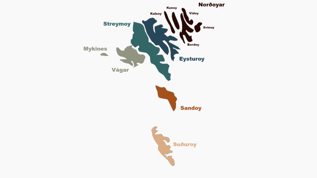
Norðoya
Faroes Pt.1 – The Northern Isles
Introduction
20 April – 1 May 2023
With some time free, my mum suggested a spring trip and a return to the Faroe Islands was soon in the cards. The only alternative destination seriously considered was Red Rocks, USA (Grand Canyon, Bryce Canyon, Zion, etc). Both are destinations I’d previously visited, but both well worth a return. The differences in flight time and an increasingly negative opinion of the US National Parks made the decision easier. Atlantic Air even flies direct from Edinburgh to Vágar!
The first trip to the Faroes was a Christmas trip in 2019. That was a nice trip, but ultimately a little disappointing. Winter in the Faroes has short daylight hours and is characterised by heavy cloud and frequent rain. This was known when planning, but it was hoped that a winter trip would be rewarded with soft lighting and snowcapped hills. Unfortunately, it was too warm for snow and the layers of dense cloud meant the winter lighting only delivered on rare occasions. That’s just the way things go when visiting these destinations though – sometimes the weather gods just aren’t smiling on you.
Given the unfinished business, I had long been considering a return to the Faroes. Unlike most of their North Atlantic neighbours, the Faroes do not have the Right to Roam. This meant wildcamping was out of the question. Given highly volatile weather, camping would have been a hard sell regardless though. I had always envisioned a return trip would be best suited to late spring: late-May/early-June, with the expectation of seeing the islands at their emerald green best. Late-April was at risk of being awkward fringe-season, with a muddy-brown aesthetic.
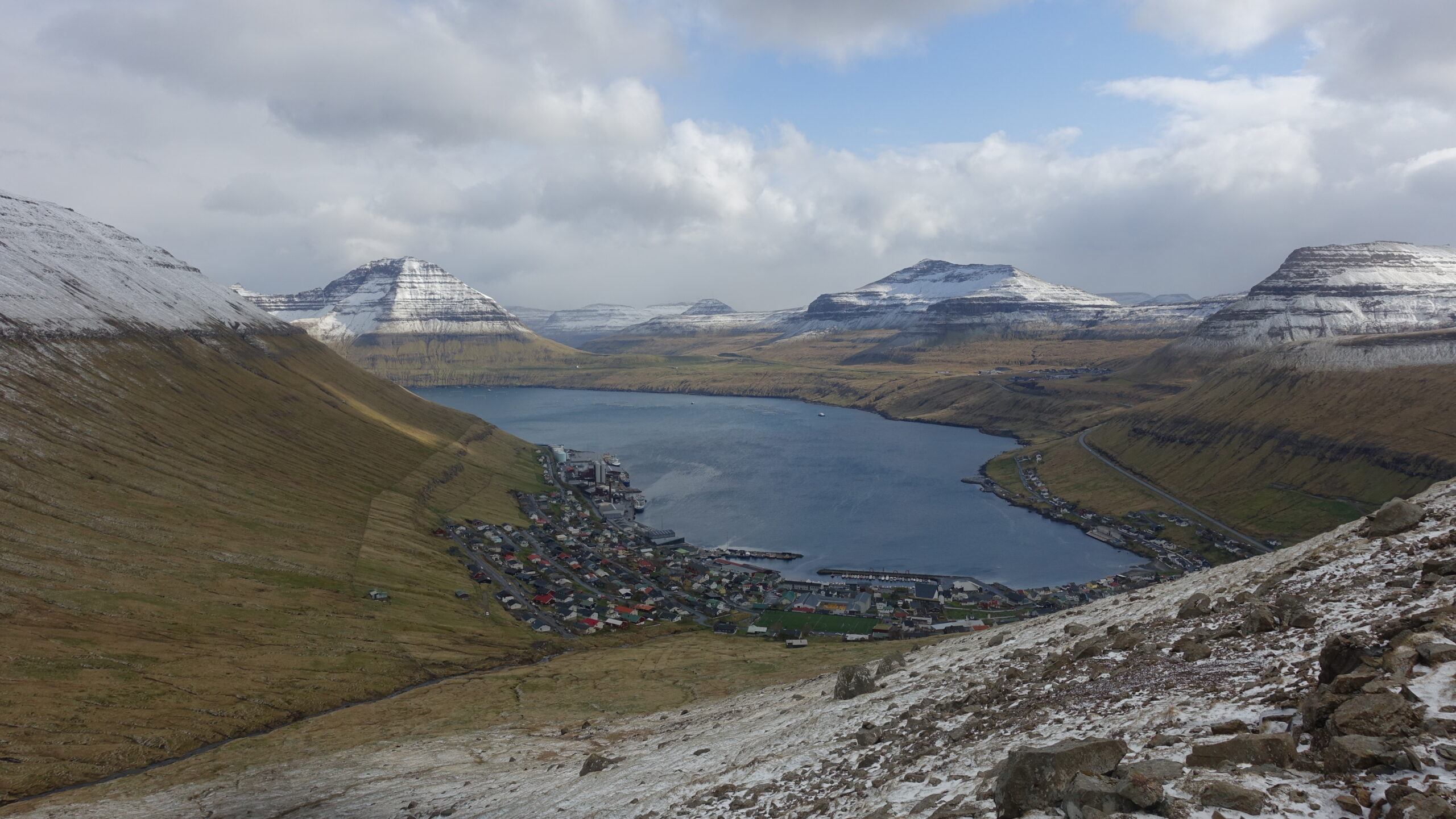
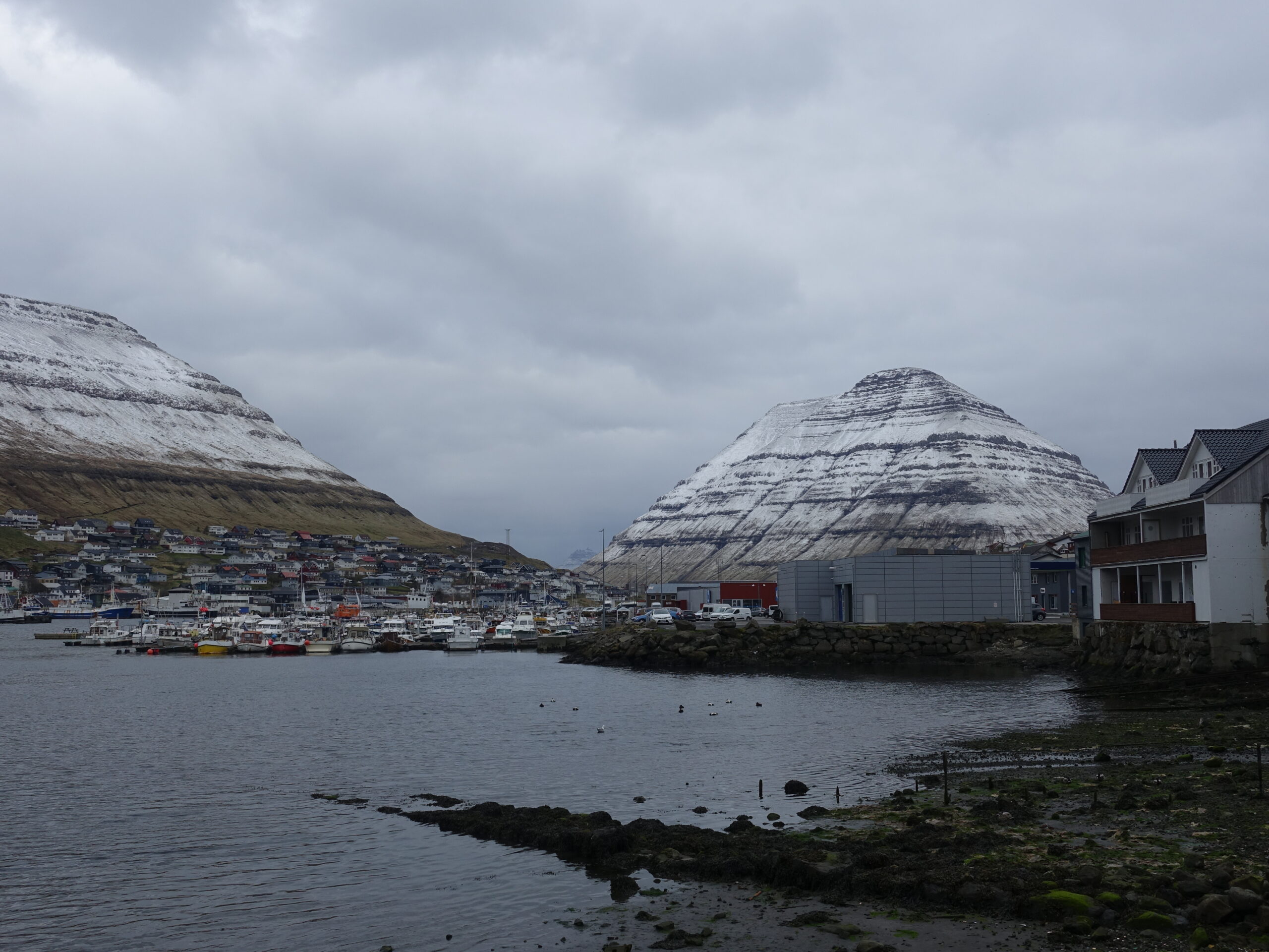
Like the last trip, we would split our time between north and south. In the North, we stayed on Borðoy in the same Klaksvik AirBnB as the first trip. In the south, we moved from Tórshavn to Miðvágur. The change would allow for more convenient hiking options.
Arrival
Thursday, 20 April
Flying into Vágar Airport is always a joy. Even with a 500m extension in 2011, the runway is only just long enough for the A319. Regardless of direction, passengers are treated to impressive views (pilots get unique challenges). This time, we landed on Runway 12, which meant the particularly interesting western approach. Final was nearly level with the hills as we slotted between Tindhólmur and Gásadalur.
Upon landing, I was somewhat disappointed by the warm temperatures and cloudless sky. I’m rarely one to complain about clear skies when hiking, but there is something that just doesn’t look right about the North Atlantic Islands under direct sun.
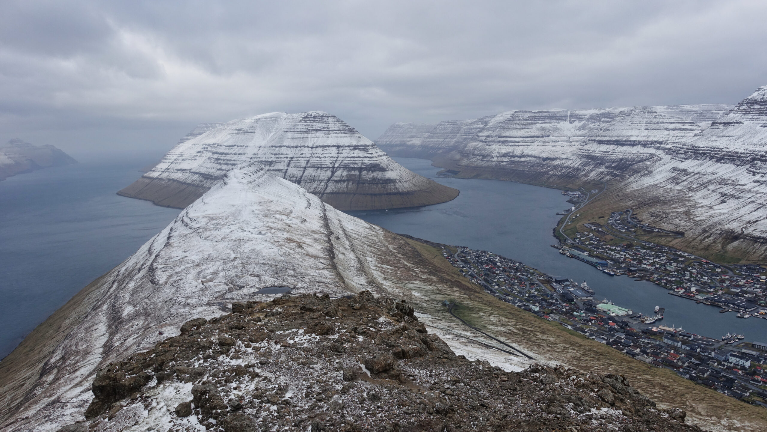
We picked up the rental car, stopped for groceries, and started the 1.5 hour drive north. About 15 minutes in, the engine cut-out. It was clearly a transmission problem and the vehicle was completely bricked. We were given a temporary replacement, but he would need it back in a two days. The significant delay meant we arrived into Klaksvik as the sun was already setting. I had intended to head directly out to a dramatic city overlook at Klakkur. That would be an unwinnable race with the already setting sun though. Instead I headed around the side of Myrkanayrarfjal, seeing how far I could get.
North Eysturoy
Friday – 21 April
The first full day would go about as well as the arrival.
It was another warm, cloudless day. Being in a region of unstable weather and unsure of what the future would bring, I was keen to make the most of it. The plan was to start with the Klakkur viewpoint above Klaksvik, before heading to northern Eysturoy. The primary goal was Slættaratindur, the highest point on the islands. After that, there was an amorphous collection of possible stops on the drive back to Klaksvik.
Arriving at the Slættaratindur car park, there was a very clear ‘Closed for Maintenance’ sign. A few times a year, the Faroes mobilise for a mass-maintenance effort. They have even turned these events into tourist attractions. It is important to keep frequently used tracks in good order and it is fun that they turn maintenance into an event. Unfortunately, it was not clearly listed online unless you knew exactly where and when to look. As keen as I am on the right to roam, and find it dubious that an entire mountain needs to be closed for trail maintenance (happy to point them in the direction of organisations that take on far larger maintenance projects with less disruption), there was a clear request and I wanted to honour that.
The next stop was intended to be Gjogv, just a few minutes drive away. I had very positive memories of this dramatic village from the first trip. The return presented a radically different feeling. Driving in, there were queues of cars on the tiny village roads. The main attraction in town is walking along the cliffs above town offering dramatic views across town to Tyril and across the water to Kalsoy. In the years between visits, the track had been boardwalked and the cliffs fenced off. I fully understand the rational: the boardwalk, in particular, will help dramatically with erosion generated by ever increasing crowds. That doesn’t change the fact that it significantly reduced the appeal of what was already a very easy walk. I had considered doing a full horseshoe circuit of the hills above town, but was feeling extremely apathetic and cut things short.
Two of my day-plans had just been ripped up and it was only midday. I was in danger of wasting the day and needed to come up with an alternative plan. I had done considerable research, but had exhausted the options set out for the day. Chasing the sunk-costs fallacy and diving further out of our way didn’t seem an attractive option. Eventually I recalled a hike above Liervik. Being just on the Eysturoy side of Norðoyatunnilin, it was on our way back regardless.
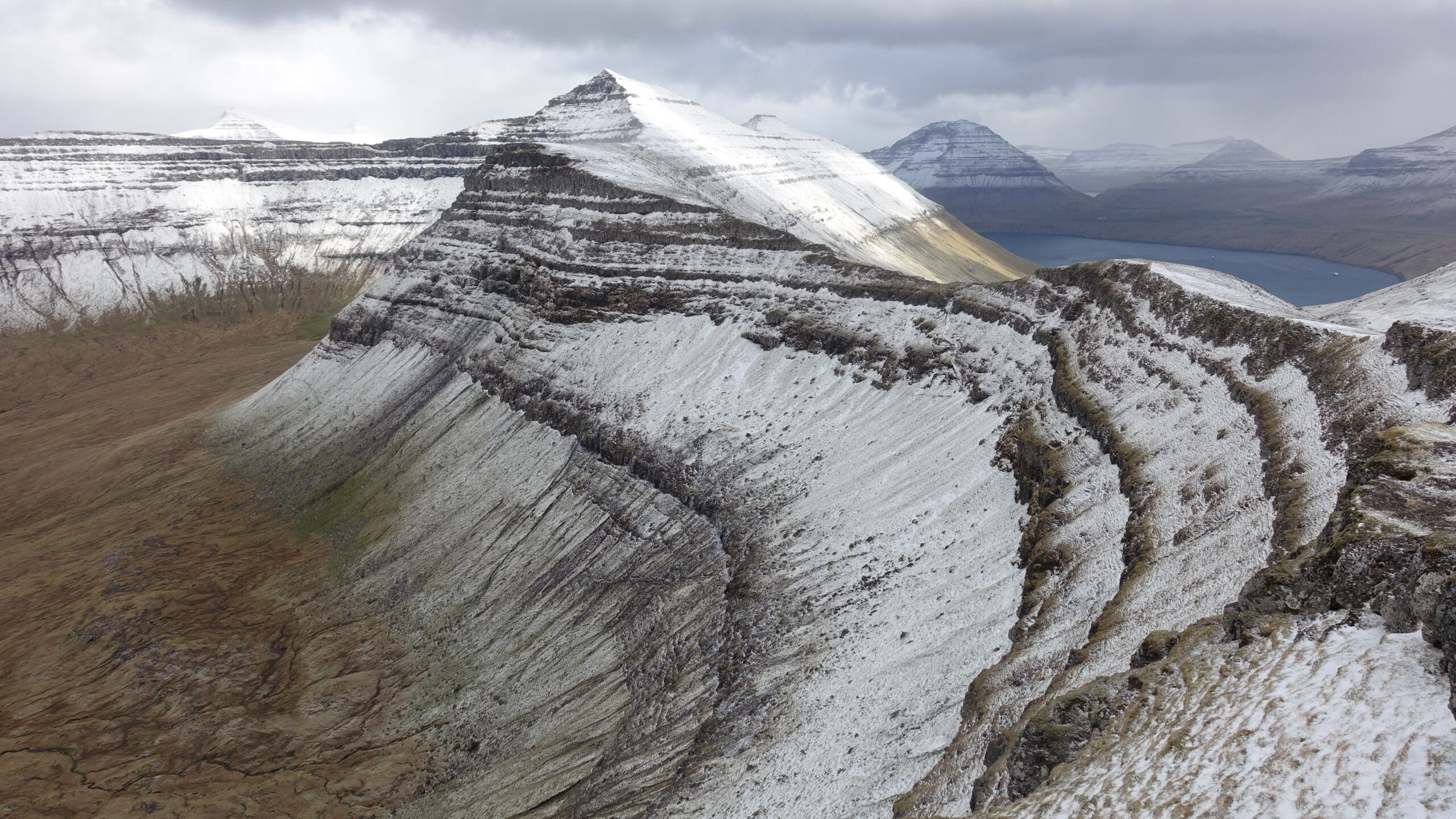
The hike was an inter-village bootpath that had historically connected Liervik to Norðragøta via a steep pass. At the top of the pass, instead of descending, I took the ridge for a delightful [British] Grade II/III scramble. Unlike my exploits earlier in the day, this hill really delivered. I had exceptional views of Norðoya and the scramble was just the right technical grade. I could easily have spent several hours up there. I had agreed to be back at a certain time though, so descended far too quickly.
Our temporary car was picked up when we returned.

Sigatindur salvages the day – view from just below the pass
In the evening, I returned to Klakkur in hopes of catching the sunset. Setting off around 20:30, I timed it just about perfectly. The combination of incoming cloud and sunset led to some spectacular colours looking southeast over Klaksvik.

Evening hiking above Klaksvik
Áarskarð
Saturday – 22 April
Since arrival, we had been hearing that a series of storms would be rolling in to break the summer weather. Waking the next morning, it was clear that the season was reverting to spring – ominously heavy cloud was threatening.
Since we were now without a car, we were unable to chase better local weather. Not wanting to waste the day, I set out, back along the base of Myrkanayrarfjal for a route steeped in local history. I was headed toward Áarskarð. I quickly passed Grindasteinur, my turn around point from the evening of our arrival. According to legend, this boulder is where the start of a Pilot Whale hunt was shouted down to the harbour below. I continued to the pass and up to Katlarnir, where the Thing (Viking parliament) was held for centuries. Throughout the morning there was intermittent rain, with the tops of the hills starting to accumulate a dusting of snow, but the rain really picked up a little beyond the pass. I had hoped to continue exploring the ridges above Árnafjørður, but decided I’d hit diminishing returns, given the weather, and turned around.
Heavy rain and snow would hammer Borðoy all afternoon. There would be no evening excursion.


A very wet trip to Seyringaskarð
Hálgafelli
Sunday – 23 April
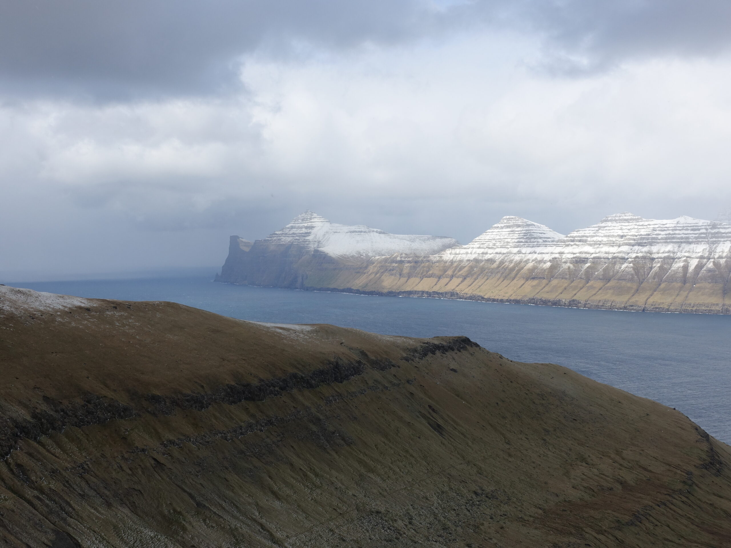
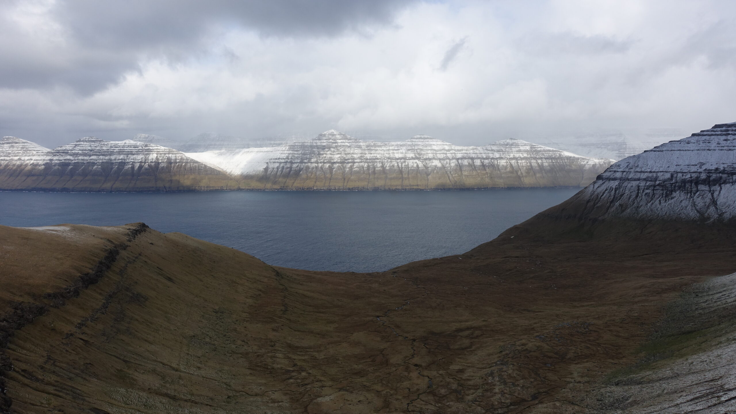
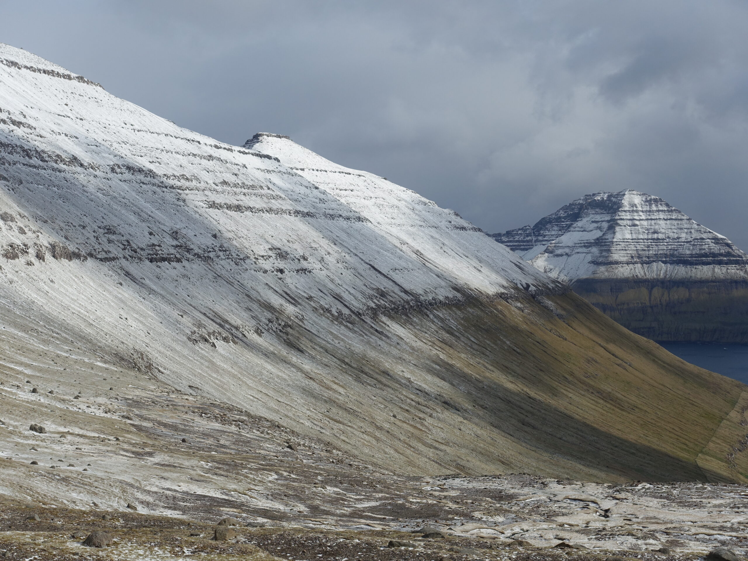
The storm really settled in overnight. A snowline had formed at about 50m, leading to that ‘layered’ look that suits the North Atlantic Islands so well. This was exactly what I was hoping for from the 2019 winter trip! Still without a car, and with highly temperamental weather putting me off committing to a long day out on Kalsoy via ferry, I stayed local.
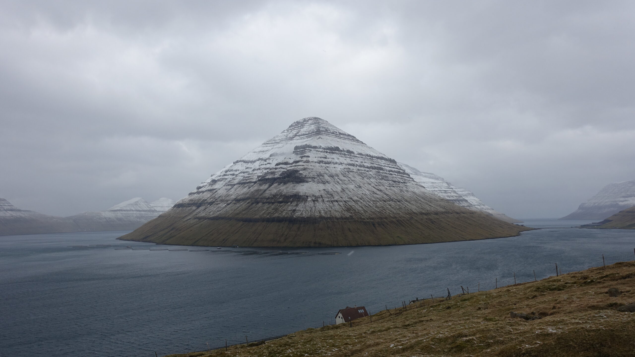
The south end of Kunoy: photogenic, as always
Once again, I headed across town to the area with the Klakkur viewpoint. Instead of heading north to the standard viewpoint, I headed south for a scramble up Hálgafelli. As soon as I turned, I was absolutely blasted by the infamous Faroese wind – something I was very familiar with after the last trip… Sunglasses were essential due to the hail-like snow being blasted straight into my face. As I approached the flattened top of Hálgafelli, the wind became nearly untenable – I couldn’t stand upright. I had wanted to continue to Háfjall, but that just didn’t seem either a pleasant or smart idea. Looking back, instead of heading directly up Hafjell, I could have attempted to skirt around to the saddle between Hálgafelli and Háfjall. This may have given me enough of a reprieve from the wind to allow push.
Stormy evenings around Hálgafelli
Fuglafjørður
Monday – 24 April
The next morning there was also a chance that our AirBnB host might lend us her car for the day. We weren’t sure if or when this might happen. I didn’t want to wait around waiting for something that might never happen, so set out for the closest option, back toward Áarskarð. I was sure to keep a keen eye on my phone though.
Sure enough, before long I received a text – we had a car! I hurried back and we made a plan for the afternoon.


Back to Seyringaskarð
I was ready to go with the destination: Fuglafjørður: a dramatically positioned village in western Eysturoy. It was nearby and has a series of ridges above town that looked an absolute delight – particularly with the current dusting of snow.
As with most Faroese circuits, this one started with an old inter-village track – this time toward Hellurnar. I departed in the sun, but was in a whiteout by the time I crossed into the first farm-field. At a saddle, I turned off to ascend Rustartindur and followed the ridge to Húsafelli. Every step of the way, I had to battle the wind and sleet as the weather constantly moved in and out. The views from the ridge were absolutely worth it though: I had very moody views of the Kalsoy.
As with Liervik, there was plenty more for me to do. But I had promised to be out a maximum amount of time, so headed back down.
Stormy hike above Funningsfjørður
In the evening, I returned to Hálgafelli. The wind was as bad as ever, but it was clear that the clouds were breaking. I was treated to an exceptional sunset over Kalsoy and Eysuroy. By this point I was growing quite tired of the long slog on road, the views from the scramble made it worthwhile though.


Back to Hálgafelli. Lighting would have been better in the morning
Onward Journey
Tuesday – 25 April
The host we rented the bricked car from picked us up in Klaksvik the morning of the transit day. The weather had [very locally] cleared and I was wishing that I had time to get one more trip to Hálgafelli or Klakkur in. Instead, I walked to the end of town for some fantastic lighting on the south end of Kunoy.


Perfect [local] weather on the final morning
Afterwards
The trip got off to a terrible start with the car problems. Despite this, as well as the extremely volatile spring weather, it ended up being a very memorable return to the region!
- Spring in the North Atlantic never fails to surprise. Flipping from high summer to deep winter in a matter of hours. In late-April, we had the winter conditions I was hoping for with the previous December trip.
- Unfortunately, the Faroes are rapidly headed down the same road as Iceland: over tourism and carefully curated ‘hiking’ experiences are just around the corner.
- Unlike most of their Nordic neighbours (and Scotland), the Faroes have never had the right to roam. There was a distinct increase in the number of hikes being pay-walled, often to extortionate levels
- With more friendly laws and less volatile weather, the Faroes would be an ideal wildcamping destination. Instead, I was very glad to be staying in AirBnBs
- Transportation complications and volatile weather meant I was unable to get out to as many different islands as I had hoped. Perhaps I should have braved the storms more, but I think I got the balance about right.
- No matter how much I accomplish, I always feel I could/should have done more. There are always more hills to climb.
Footnote
All photos are exclusive property and may not be copied, downloaded, reproduced, manipulated or used in any way without permission of the photographer.
Favourite Stories